 |
SEALEVEL STATION CATALOG (SSC) |
|
|
|
|
|
| Station catalog metadata [edit] | [station overview] |
|---|
| SSC ID | SSC-ptis | | Station Name | Port Isaac | | Country | United Kingdom | | Latitude | 50.59417 | | Longitude | -4.83441 | | DateLastModified | 2015-10-22 19:02:29 |
| Linked codes |
|---|
| Codes | Location | Latitude | Longitude | Sensors | IOC: ptis | Port Isaac | 50.59417 | -4.83441 | stp |
PSMSL: 2284 | PORT ISAAC | 50.59419 | -4.834412 | N/A |
| Distributed metadata source: IOC Sea Level Station Monitoring Facility ptis |
|---|
| Status | Operational |
| Local Contact | Channel Coastal Observatory ( UK ) |
| Connection | WEB service |
| Country | UK |
| Sensor 1 | |
| Type of sensor | stp |
| Sampling rate (min) | 0.1666 |
| Distributed metadata source: PSMSL |
| Name | PORT ISAAC |
| SONEL id | 4318 |
| Is RLR | Y |
| Has RLR Diagram | Y link |
| QC Flag | N |
| Old ID | 170/162 |
| Last Updated | 2025-10-01 |
| Supplier | CHANNEL COASTAL OBSERVATORY |
| Address | National Oceanography Centre, Waterfront Campus, European Way, Southampton, UNITED KINGDOM |
| Metric Start | 2010 |
| Metric End | 2024 |
| Metric Completeness | 81.7 |
| RLR Start | 2010 |
| RLR End | 2024 |
| RLR Completeness | 81.7 |
| Download metric sea level data. | Use only with extreme caution. |
IOC Sea Level Station Monitoring Facility - realtime graph for 'ptis' 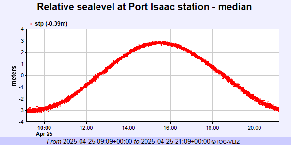 PSMSL Annual Mean Sea Level for '2284' 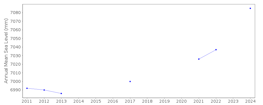 PSMSL Monthly Mean Sea Level for '2284' 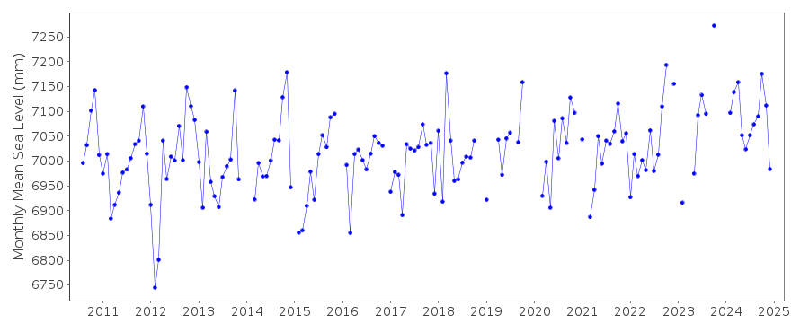
|
|
|