 |
SEALEVEL STATION CATALOG (SSC) |
|
|
|
|
|
| Station catalog metadata [edit] | [station overview] |
|---|
| SSC ID | SSC-sandu | | Station Name | Sandnessjoen | | Country | Norway | | Latitude | 66.016667 | | Longitude | 12.633333 | | DateLastModified | 2015-10-22 19:02:29 |
| Linked codes |
|---|
| Codes | Location | Latitude | Longitude | Sensors | PSMSL: 1137 | SANDNESSJOEN | 66.016667 | 12.633333 | N/A |
| Distributed metadata source: PSMSL |
| Name | SANDNESSJOEN |
| Is RLR | Y |
| Has RLR Diagram | Y link |
| QC Flag | N |
| Old ID | 040/117 |
| Last Updated | null |
| Supplier | NORWEGIAN MAPPING AUTHORITY |
| Address | Norwegian Mapping Authority, Hydrographic Service , Po. Box 60, 4001 Stavanger, NORWAY |
| Metric Start | 1965 |
| Metric End | 1974 |
| Metric Completeness | 93.3 |
| RLR Start | 1965 |
| RLR End | 1974 |
| RLR Completeness | 93.3 |
| Download metric sea level data. | Use only with extreme caution. |
PSMSL Annual Mean Sea Level for '1137' 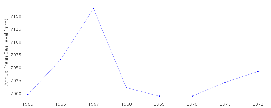 PSMSL Monthly Mean Sea Level for '1137' 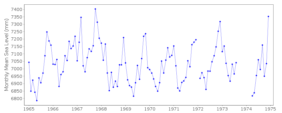
|
|
|