 |
SEALEVEL STATION CATALOG (SSC) |
|
|
|
|
|
| Station catalog metadata [edit] | [station overview] |
|---|
| SSC ID | SSC-ptts | | Station Name | Porto Torres | | Country | Italy | | Latitude | 40.8422 | | Longitude | 8.4039 | | DateLastModified | 2015-10-22 19:32:52 |
| Linked codes |
|---|
| Codes | Location | Latitude | Longitude | Sensors | IOC: PT17 | Porto Torres | 40.8422 | 8.4039 | rad |
PSMSL: 2084 | PORTO TORRES | 40.842206 | 8.403914 | N/A |
| Distributed metadata source: IOC Sea Level Station Monitoring Facility PT17 |
|---|
| Status | Operational |
| Local Contact | Istituto Superiore per la Protezione e la Ricerca Ambientale ( Italy ) |
| Connection | WEB service |
| Country | Italy |
| Sensor 1 | |
| Type of sensor | rad |
| Sampling rate (min) | 1 |
| Distributed metadata source: PSMSL |
| Name | PORTO TORRES |
| Is RLR | Y |
| Has RLR Diagram | Y link |
| QC Flag | N |
| Old ID | 240/006 |
| Last Updated | 2026-05-08 |
| Supplier | ISPRA |
| Address | Institute for Environmental Protection and Research, Via Vitaliano , Brancati 48, 00144 Roma, ITALY |
| Metric Start | 2001 |
| Metric End | 2025 |
| Metric Completeness | 85.0 |
| RLR Start | 2001 |
| RLR End | 2025 |
| RLR Completeness | 85.0 |
| Download metric sea level data. | Use only with extreme caution. |
IOC Sea Level Station Monitoring Facility - realtime graph for 'PT17' 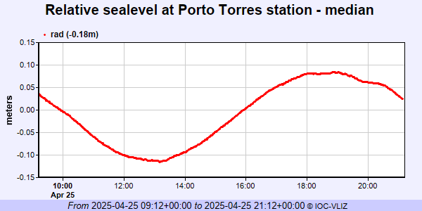 PSMSL Annual Mean Sea Level for '2084' 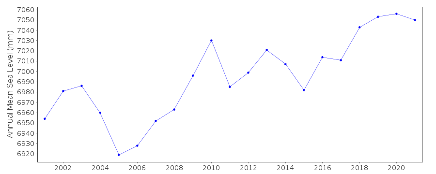 PSMSL Monthly Mean Sea Level for '2084' 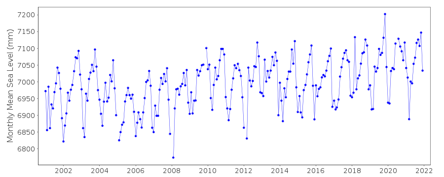
|
|
|