 |
SEALEVEL STATION CATALOG (SSC) |
|
|
|
|
|
| Station catalog metadata [edit] | [station overview] |
|---|
| SSC ID | SSC-portm | | Station Name | Port-saint-francois | | Country | Canada | | Latitude | 46.266667 | | Longitude | -72.616667 | | DateLastModified | 2015-10-22 19:02:29 |
| Linked codes |
|---|
| Codes | Location | Latitude | Longitude | Sensors | PSMSL: 137 | PORT-SAINT-FRANCOIS | 46.266667 | -72.616667 | N/A |
| Distributed metadata source: PSMSL |
| Name | PORT-SAINT-FRANCOIS |
| Is RLR | Y |
| Has RLR Diagram | Y link |
| QC Flag | N |
| Old ID | 970/076 |
| Last Updated | 2025-06-19 |
| Supplier | CANADIAN HYDROGRAPHIC SERVICE |
| Address | Canadian Hydrographic Service, 615 Booth Street, Ottawa , Ontario K1A 0E6, CANADA |
| Metric Start | 1900 |
| Metric End | 2024 |
| Metric Completeness | 38.9 |
| RLR Start | 1961 |
| RLR End | 2024 |
| RLR Completeness | 72.8 |
| Download metric sea level data. | Use only with extreme caution. |
PSMSL Annual Mean Sea Level for '137' 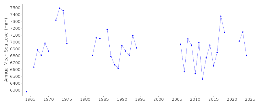 PSMSL Monthly Mean Sea Level for '137' 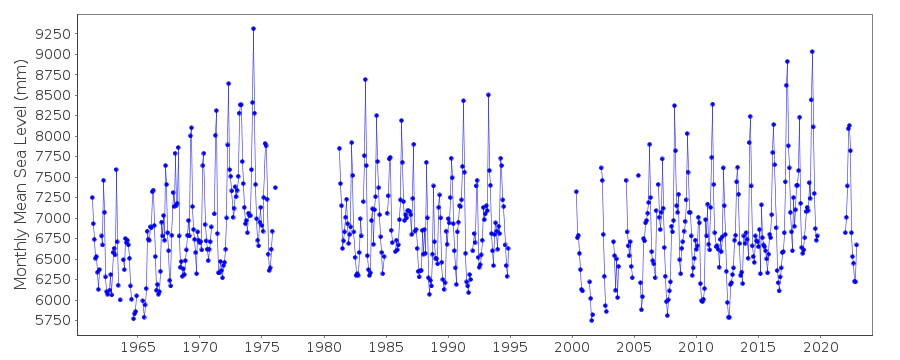
|
|
|