 |
SEALEVEL STATION CATALOG (SSC) |
|
|
|
|
|
| Station catalog metadata [edit] | [station overview] |
|---|
| SSC ID | SSC-monte | | Station Name | Montevideo | | Country | Uruguay | | Latitude | -34.9 | | Longitude | -56.25 | | DateLastModified | 2015-10-22 19:02:29 |
| Distributed metadata source: GLOSS Station Handbook |
|---|
| Time Zone | 045W, GMT - 3hrs | | Ocean | Atlantic | | Operational | Yes | | Responsible country | Uruguay | | Data acquisition rate | 60 minute intervals | | Other relevant information | Data from other gauges at Muelle Washington
(1938-1946, 1954-1971) and Muelle Mantaras
(1975-1983) held by PSMSL. |
| Distributed metadata source: PSMSL |
| Name | MONTEVIDEO (PUNTA LOBOS) |
| GLOSS id | 300 |
| SONEL id | 3616 |
| Is RLR | Y |
| Has RLR Diagram | Y link |
| QC Flag | N |
| Old ID | 870/011 |
| Last Updated | 2026-06-12 |
| Supplier | SOHMA |
| Address | SOHMA (Oceanographic, Hydrography and, Meteorology Service of the Uruguayan Navy), Capurro 980, MONTEVIDEO, URUGUAY |
| Metric Start | 1938 |
| Metric End | 2025 |
| Metric Completeness | 81.8 |
| RLR Start | 1938 |
| RLR End | 2025 |
| RLR Completeness | 81.8 |
| Download metric sea level data. | Use only with extreme caution. |
PSMSL Annual Mean Sea Level for '431'  PSMSL Monthly Mean Sea Level for '431' 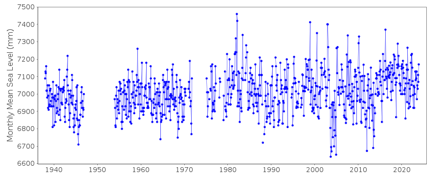
|
|
|