 |
SEALEVEL STATION CATALOG (SSC) |
|
|
|
|
|
| Station catalog metadata [edit] | [station overview] |
|---|
| SSC ID | SSC-ment | | Station Name | Mentesizmir | | Country | Turkey | | Latitude | 38.433333 | | Longitude | 26.716667 | | DateLastModified | 2015-10-22 19:02:29 |
| Distributed metadata source: IOC Sea Level Station Monitoring Facility ment |
|---|
| Status | Operational |
| Local Contact | General Directorate of Mapping ( Turkey ) |
| Connection | WEB service |
| Country | Turkey |
| Sensor 1 | |
| Type of sensor | rad |
| Sampling rate (min) | 0.5 |
| Distributed metadata source: PSMSL |
| Name | MENTES/IZMIR |
| Is RLR | Y |
| Has RLR Diagram | Y link |
| QC Flag | N |
| Old ID | 310/042 |
| Last Updated | 2013-07-09 |
| Supplier | GENERAL DIRECTORATE OF MAPPING |
| Address | General Directorate of Mapping, Tlp Fakultesi Cad, 06590 Cebeci/Cankaya, Ankara, TÜRKİYE |
| Metric Start | 1985 |
| Metric End | 2009 |
| Metric Completeness | 88.7 |
| RLR Start | 1985 |
| RLR End | 2009 |
| RLR Completeness | 88.7 |
| Download metric sea level data. | Use only with extreme caution. |
IOC Sea Level Station Monitoring Facility - realtime graph for 'ment' 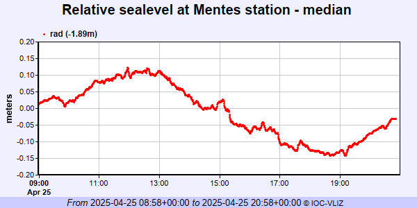 PSMSL Annual Mean Sea Level for '1679' 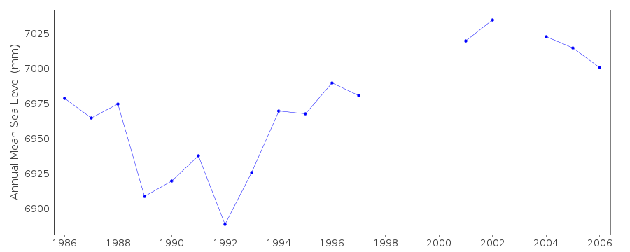 PSMSL Monthly Mean Sea Level for '1679' 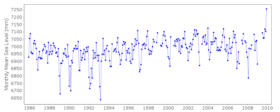
|
|
|