 |
SEALEVEL STATION CATALOG (SSC) |
|
|
|
|
|
| Station catalog metadata [edit] | [station overview] |
|---|
| SSC ID | SSC-kris | | Station Name | Kristiansund | | Country | Norway | | Latitude | 63.113859 | | Longitude | 7.734352 | | DateLastModified | 2024-02-12 15:21:30 |
| Linked codes |
|---|
| Codes | Location | Latitude | Longitude | Sensors | IOC: kris | Kristiansund | 63.113859 | 7.734352 | flt |
PSMSL: 682 | KRISTIANSUND | 63.113859 | 7.734352 | N/A |
| Distributed metadata source: IOC Sea Level Station Monitoring Facility kris |
|---|
| Status | Operational |
| Local Contact | Norwegian Hydrographic Service ( Norway ) |
| Connection | WEB service |
| Country | Norway |
| Sensor 1 | |
| Type of sensor | flt |
| Sampling rate (min) | 10 |
| Distributed metadata source: PSMSL |
| Name | KRISTIANSUND |
| Is RLR | Y |
| Has RLR Diagram | Y link |
| QC Flag | N |
| Old ID | 040/161 |
| Last Updated | 2026-01-30 |
| Supplier | NORWEGIAN MAPPING AUTHORITY |
| Address | Norwegian Mapping Authority, Hydrographic Service , Po. Box 60, 4001 Stavanger, NORWAY |
| Metric Start | 1952 |
| Metric End | 2025 |
| Metric Completeness | 98.5 |
| RLR Start | 1952 |
| RLR End | 2025 |
| RLR Completeness | 98.5 |
| Download metric sea level data. | Use only with extreme caution. |
IOC Sea Level Station Monitoring Facility - realtime graph for 'kris' 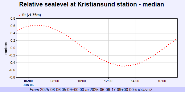 PSMSL Annual Mean Sea Level for '682' 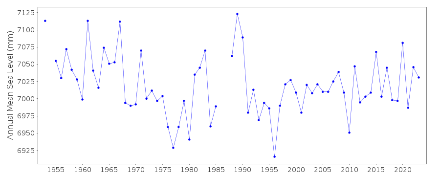 PSMSL Monthly Mean Sea Level for '682' 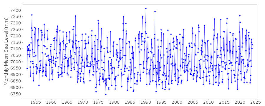
|
|
|