 |
SEALEVEL STATION CATALOG (SSC) |
|
|
|
|
|
| Station catalog metadata [edit] | [station overview] |
|---|
| SSC ID | SSC-kata | | Station Name | Katakolo | | Country | Greece | | Latitude | 37.64045 | | Longitude | 21.319233 | | DateLastModified | 2015-10-22 19:02:29 |
| Linked codes |
|---|
| Codes | Location | Latitude | Longitude | Sensors | IOC: kata | Katakolo | 37.64045 | 21.319233 | pr1 |
PSMSL: 1240 | KATAKOLON | 37.644822 | 21.319681 | N/A |
| Distributed metadata source: IOC Sea Level Station Monitoring Facility kata |
|---|
| Status | Operational |
| Local Contact | Hellenic Navy Hydrographic Service ( Greece ) |
| Connection | FTP box |
| Country | Greece |
| Sensor 1 | |
| Type of sensor | pr1 |
| Sampling rate (min) | 1 |
| Distributed metadata source: PSMSL |
| Name | KATAKOLON |
| SONEL id | 4157 |
| Is RLR | Y |
| Has RLR Diagram | Y link |
| QC Flag | N |
| Old ID | 290/017 |
| Last Updated | 2025-04-16 |
| Supplier | HELLENIC NAVY HYDROGRAPHIC SERVICE |
| Address | Hellenic Navy Hydrographic Service, Geographic Policy and International Relations Office, TGN 1040, Athens, GREECE |
| Metric Start | 1969 |
| Metric End | 2024 |
| Metric Completeness | 88.5 |
| RLR Start | 1969 |
| RLR End | 2024 |
| RLR Completeness | 88.5 |
| Download metric sea level data. | Use only with extreme caution. |
IOC Sea Level Station Monitoring Facility - realtime graph for 'kata' 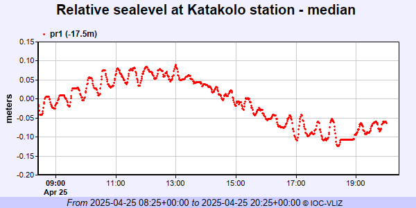 PSMSL Annual Mean Sea Level for '1240' 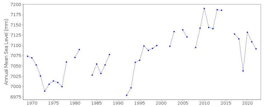 PSMSL Monthly Mean Sea Level for '1240' 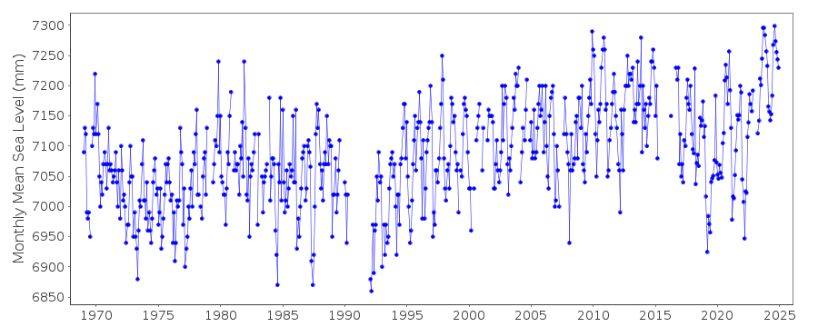
|
|
|