 |
SEALEVEL STATION CATALOG (SSC) |
|
|
|
|
|
| Station catalog metadata [edit] | [station overview] |
|---|
| SSC ID | SSC-hoek | | Station Name | Hoek Van Holland | | Country | Netherlands | | Latitude | 51.9775 | | Longitude | 4.12 | | DateLastModified | 2015-10-22 19:02:29 |
| Linked codes |
|---|
| Codes | Location | Latitude | Longitude | Sensors | IOC: hoek | Hoek van Holland | 51.9774704941 | 4.11949106655 | flt |
PSMSL: 22 | HOEK VAN HOLLAND | 51.9775 | 4.12 | N/A |
| Distributed metadata source: IOC Sea Level Station Monitoring Facility hoek |
|---|
| Status | Operational |
| Local Contact | Rijkswaterstaat ( Netherlands ) |
| Connection | WEB service |
| Country | Netherlands |
| Sensor 1 | |
| Type of sensor | flt |
| Sampling rate (min) | 10 |
| Distributed metadata source: PSMSL |
| Name | HOEK VAN HOLLAND |
| SONEL id | 4504 |
| Is RLR | Y |
| Has RLR Diagram | Y link |
| QC Flag | N |
| Old ID | 150/051 |
| Last Updated | 2025-11-14 |
| Supplier | RIJKSWATERSTAAT |
| Address | Servicedesk Data, Rijkswaterstaat, Postbus 556, 3000 AN Rotterdam , NETHERLANDS, KINGDOM OF THE |
| Metric Start | 1864 |
| Metric End | 2024 |
| Metric Completeness | 100.0 |
| RLR Start | 1864 |
| RLR End | 2024 |
| RLR Completeness | 100.0 |
| Download metric sea level data. | Use only with extreme caution. |
IOC Sea Level Station Monitoring Facility - realtime graph for 'hoek' 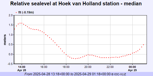 PSMSL Annual Mean Sea Level for '22' 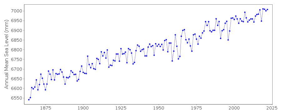 PSMSL Monthly Mean Sea Level for '22' 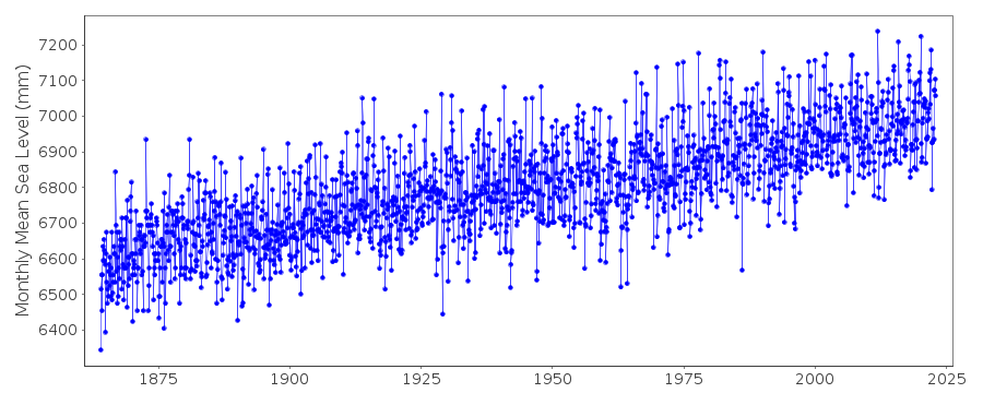
|
|
|