| Station catalog metadata [edit] | [station overview] |
|---|
| SSC ID | SSC-hien |
| Station Name | Hienghene |
| Country | France |
| Latitude | -20.69283333 |
| Longitude | 164.94216666 |
| DateLastModified | 2025-05-08 22:03:29 |
| Linked codes |
|---|
| Codes | Location | Latitude | Longitude | Sensors |
IOC: hien | Hienghene (New Caledonia) | -20.69283333 | 164.94216666 | prs, rad, bat |
IOC: hien2 | Hienghene 2 (New Caledonia) | -20.69283333 | 164.94216666 | rad |
PTWC: hien | Hienghene_New_Caledonia_F | -20.6929 | 164.9422 | prs, rad |
PSMSL: 2237 | HIENGHENE | -20.691993 | 164.943122 | N/A |
SONEL_GPS: 3562 | HIENGHENE | -20.68884593 | 164.94304320 | N/A |
SONEL_TG: 3170 | HIENGHENE | -20.69199300 | 164.94312200 | N/A |
| Distributed metadata source: IOC Sea Level Station Monitoring Facility hien |
|---|
| GTS station code | 06522296 |
| GTS message type | SZNC42 |
| Status | Operational |
| Local Contact | Service hydrographique et océanographique de la marine ( France ) |
| Other Contact | Service hydrographique et océanographique de la marine ( France ) |
| Connection | GTS message |
| Country | France |
| Sensor 1 | |
| Type of sensor | prs |
| Sampling rate (min) | 1 |
| Sensor 2 | |
| Type of sensor | rad |
| Sampling rate (min) | 1 |
| Sensor 3 | |
| Type of sensor | bat |
| Sampling rate (min) | 5 |
| Distributed metadata source: IOC Sea Level Station Monitoring Facility hien2 |
|---|
| Status | Operational |
| Local Contact | Service hydrographique et océanographique de la marine ( France ) |
| Connection | FTP box |
| Country | France |
| Sensor 1 | |
| Type of sensor | rad |
| Sampling rate (min) | 1 |
| Distributed metadata source: PTWC COMP META file |
| DCP ID | 06522296 |
| WMO | SZNC42 |
| Samp Rate | 1 |
| Num# Samp | 12 |
| Unit | M |
| Scale | 1.0000 |
| Xmt Int. | 006 |
| Fst Min. | 0002 |
| HAR | 1 |
| Owner | SHOM |
| Distributed metadata source: PSMSL |
| Name | HIENGHENE |
| SONEL id | 3562 |
| Is RLR | Y |
| Has RLR Diagram | Y link |
| QC Flag | N |
| Old ID | 740/010 |
| Last Updated | 2026-02-20 |
| Supplier | SERVICE HYD. ET OCEAN. DE LA MARINE |
| Address | SHOM, 13 rue de Chatelier, 29200 BREST , FRANCE |
| Metric Start | 1983 |
| Metric End | 2025 |
| Metric Completeness | 17.6 |
| RLR Start | 1983 |
| RLR End | 2025 |
| RLR Completeness | 17.6 |
| Download metric sea level data. | Use only with extreme caution. |
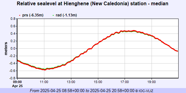
IOC Sea Level Station Monitoring Facility - realtime graph for 'hien'
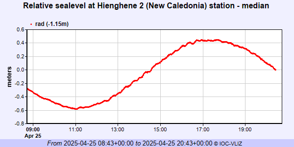
IOC Sea Level Station Monitoring Facility - realtime graph for 'hien2'
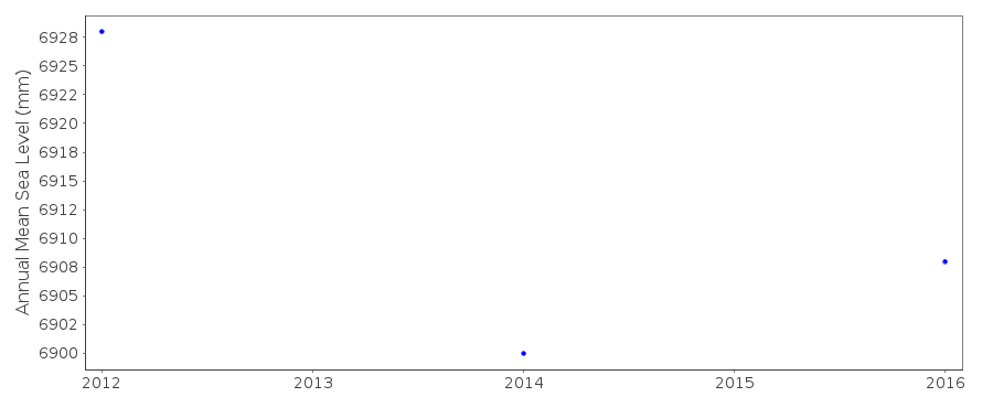
PSMSL Annual Mean Sea Level for '2237'
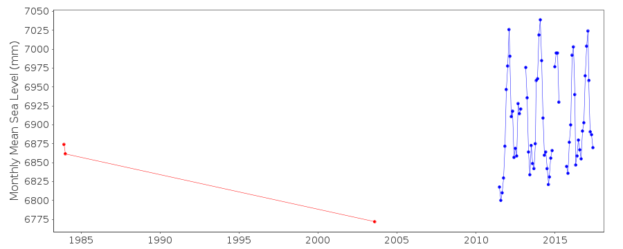
PSMSL Monthly Mean Sea Level for '2237'