| Station catalog metadata [edit] | [station overview] |
|---|
| SSC ID | SSC-calq |
| Station Name | Calliaqua |
| Country | Saint Vincent and the Grenadines |
| Latitude | 13.129912 |
| Longitude | -61.1955 |
| DateLastModified | 2015-10-22 19:02:29 |
| Linked codes |
|---|
| Codes | Location | Latitude | Longitude | Sensors |
IOC: calq | Calliaqua Coast Guard Base | 13.129912 | -61.1955 | pr2, pr1, bat |
UHSLC: 795 | Chateaubelair | 13.133 | -61.2 | N/A |
PSMSL: 2006 | KINGSTOWN | 13.133333 | -61.2 | N/A |
| Distributed metadata source: IOC Sea Level Station Monitoring Facility calq |
|---|
| GTS station code | 53500294 |
| GTS message type | SOVG10 |
| Status | Operational |
| Local Contact | National Emergency Management Office ( Saint Vincent & Grenadines ) |
| Other Contact | International Tsunami Information Center Caribbean Office ( USA ) |
| Connection | GTS message |
| Country | Saint Vincent & Grenadines |
| Sensor 1 | |
| Type of sensor | pr1 |
| Sampling rate (min) | 1 |
| Sensor 2 | |
| Type of sensor | pr2 |
| Sampling rate (min) | 1 |
| Sensor 3 | |
| Type of sensor | bat |
| Sampling rate (min) | 5 |
| Distributed metadata source: UHSLC |
| UHSLC id | 795 |
| SSC id | chat |
| UHSLC geojson | https://uhslc.soest.hawaii.edu/data/meta.geojson |
| Fast delivery | 2022-03-28 - 2026-05-31 |
| Distributed metadata source: PSMSL |
| Name | KINGSTOWN |
| UHSLC ID | 795 |
| Is RLR | N |
| Has RLR Diagram | N link |
| QC Flag | N |
| Old ID | 895/001 |
| Last Updated | 2003-01-14 |
| Supplier | C.P.A.C.C. / M.A.C.C. |
| Address | Regional Archiving Centre, University of the West Indies, St. Augustine, TRINIDAD AND TOBAGO |
| Metric Start | 2001 |
| Metric End | 2001 |
| Metric Completeness | 50.0 |
| Download metric sea level data. | Use only with extreme caution. |
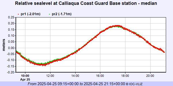
IOC Sea Level Station Monitoring Facility - realtime graph for 'calq'
PSMSL Annual Mean Sea Level for '2006'

PSMSL Monthly Mean Sea Level for '2006'

