 |
SEALEVEL STATION CATALOG (SSC) |
|
|
|
|
|
| Station catalog metadata [edit] | [station overview] |
|---|
| SSC ID | SSC-ambo | | Station Name | Ambon | | Country | Indonesia | | Latitude | -3.683333 | | Longitude | 128.18333 | | DateLastModified | 2015-10-22 19:02:29 |
| Distributed metadata source: IOC Sea Level Station Monitoring Facility ambon |
|---|
| GTS station code | 301434060409970 |
| GTS message type | SZXX01 |
| Status | Operational |
| Local Contact | Geospacial Agency of Indonesia ( Indonesia ) |
| Other Contact | University of Hawaii Sea Level Center ( USA ) |
| Connection | GTS message |
| Country | Indonesia |
| Sensor 1 | |
| Type of sensor | prs |
| Sampling rate (min) | 1 |
| Sensor 2 | |
| Type of sensor | rad |
| Sampling rate (min) | 1 |
| Sensor 3 | |
| Type of sensor | ra2 |
| Sampling rate (min) | 1 |
| Sensor 4 | |
| Type of sensor | bat |
| Sampling rate (min) | 5 |
| Sensor 5 | |
| Type of sensor | sw1 |
| Sampling rate (min) | 60 |
| Sensor 6 | |
| Type of sensor | sw2 |
| Sampling rate (min) | 60 |
| Sensor 7 | |
| Type of sensor | ras |
| Sampling rate (min) | 1 |
| Distributed metadata source: GLOSS Station Handbook |
|---|
| Time Zone | 135E, GMT + 9hrs | | Ocean | Pacific | | Operational | Yes | | Responsible country | Indonesia | | Other relevant information | Expected installation date 1992/1993 |
| Distributed metadata source: PTWC COMP META file |
| DCP ID | 301434060409970 |
| WMO | SZXX01 |
| Samp Rate | 1 |
| Num# Samp | 5 |
| Unit | M |
| Scale | 1.0000 |
| Xmt Int. | 006 |
| Fst Min. | 0002 |
| HAR | 1 |
| Owner | UHSLC |
| Distributed metadata source: UHSLC |
| UHSLC id | 133 |
| SSC id | ambon |
| GLOSS id | 68 |
| UHSLC geojson | https://uhslc.soest.hawaii.edu/data/meta.geojson |
| Research quality data version a | 1992-08-12 - 2004-07-31 |
| Research quality data version b | 2008-10-01 - 2024-12-31 |
| RQ basin | indian |
| Fast delivery | 2008-10-01 - 2026-05-31 |
| Distributed metadata source: PSMSL |
| Name | AMBON II |
| GLOSS id | 68 |
| UHSLC ID | 133 |
| Is RLR | N |
| Has RLR Diagram | N link |
| QC Flag | N |
| Old ID | 590/002 |
| Last Updated | 2015-12-08 |
| Supplier | BAKOSURTANAL |
| Address | BAKOSURTANAL, Jl Raya Jakarta-Bogar Km 46, Cibinong 16911, INDONESIA |
| Metric Start | 1992 |
| Metric End | 2008 |
| Metric Completeness | 42.6 |
| Download metric sea level data. | Use only with extreme caution. |
| Name | AMBON |
| GLOSS id | 68 |
| UHSLC ID | 133 |
| Is RLR | N |
| Has RLR Diagram | N link |
| QC Flag | N |
| Old ID | 590/001 |
| Last Updated | null |
| Supplier | INSTITUTE OF HYDRAULIC ENGINEERING |
| Address | Institute of Hydraulic Engineering, Jl. Ir. H. Juanda 193, Bandung 40135, INDONESIA |
| Metric Start | 1929 |
| Metric End | 1931 |
| Metric Completeness | 69.4 |
| Download metric sea level data. | Use only with extreme caution. |
IOC Sea Level Station Monitoring Facility - realtime graph for 'ambon' 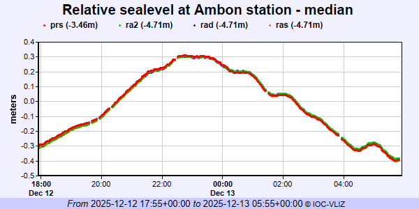 PSMSL Annual Mean Sea Level for '1815'  PSMSL Annual Mean Sea Level for '347'  PSMSL Monthly Mean Sea Level for '347' 
|
|
|