 |
SEALEVEL STATION CATALOG (SSC) |
|
|
|
|
|
| Station catalog metadata [edit] | [station overview] |
|---|
| SSC ID | SSC-abed | | Station Name | Aberdeen | | Country | United Kingdom | | Latitude | 57.14 | | Longitude | -2.08 | | DateLastModified | 2015-10-22 19:02:29 |
| Distributed metadata source: IOC Sea Level Station Monitoring Facility abed |
|---|
| Status | Operational |
| Local Contact | National Oceanography Centre ( UK ) |
| Connection | FTP box |
| Country | UK |
| Sensor 1 | |
| Type of sensor | bub |
| Sampling rate (min) | 15 |
| Distributed metadata source: PSMSL |
| Name | ABERDEEN II |
| SONEL id | 617 |
| Is RLR | Y |
| Has RLR Diagram | Y link |
| QC Flag | N |
| Old ID | 170/012 |
| Last Updated | null |
| Supplier | ABERDEEN HARBOUR BOARD |
| Address | Aberdeen Harbour Board, 16 Regent Quay, Aberdeen, UNITED KINGDOM |
| Metric Start | 1862 |
| Metric End | 1965 |
| Metric Completeness | 99.5 |
| RLR Start | 1862 |
| RLR End | 1965 |
| RLR Completeness | 99.5 |
| Download metric sea level data. | Use only with extreme caution. |
| Name | ABERDEEN I |
| SONEL id | 617 |
| Is RLR | Y |
| Has RLR Diagram | Y link |
| QC Flag | N |
| Old ID | 170/011 |
| Last Updated | 2026-02-19 |
| Supplier | ENVIRONMENT AGENCY |
| Address | Environment Agency, Horizon House, Deanery Road, BS1 5AH, Bristol, UNITED KINGDOM |
| Metric Start | 1931 |
| Metric End | 2025 |
| Metric Completeness | 84.6 |
| RLR Start | 1931 |
| RLR End | 2025 |
| RLR Completeness | 84.6 |
| Download metric sea level data. | Use only with extreme caution. |
IOC Sea Level Station Monitoring Facility - realtime graph for 'abed' 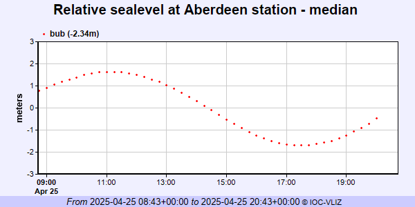 PSMSL Annual Mean Sea Level for '21' 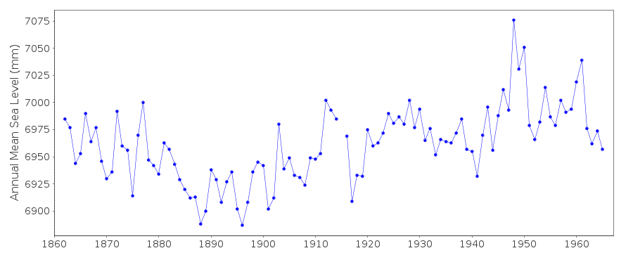 PSMSL Annual Mean Sea Level for '361' 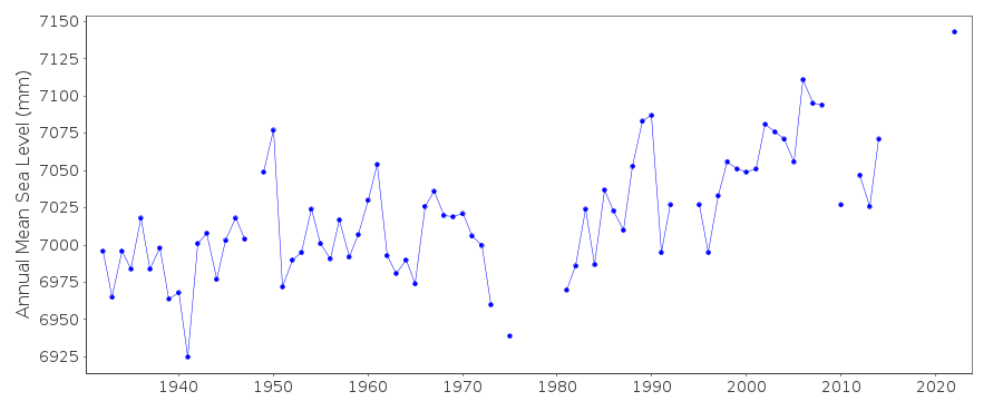 PSMSL Monthly Mean Sea Level for '361' 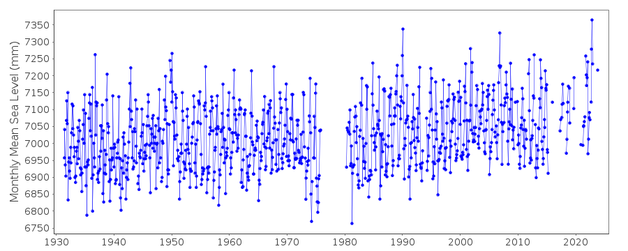
|
|
|